

AEF Crop Intelligence – Digital Twin for precision agriculture
Client: Internal project (alpha)
Turn your fields into actionable Digital Twins
Monitoring, simulation and action plans in a single tool. Reduce losses, optimize irrigation and nutrition, and generate actionable technical reports.
Epidemic risk reduction
Early satellite detection + epidemiological model → targeted preventive actions.
-84 % final severity avoided (cocoa case)
Input & water optimization
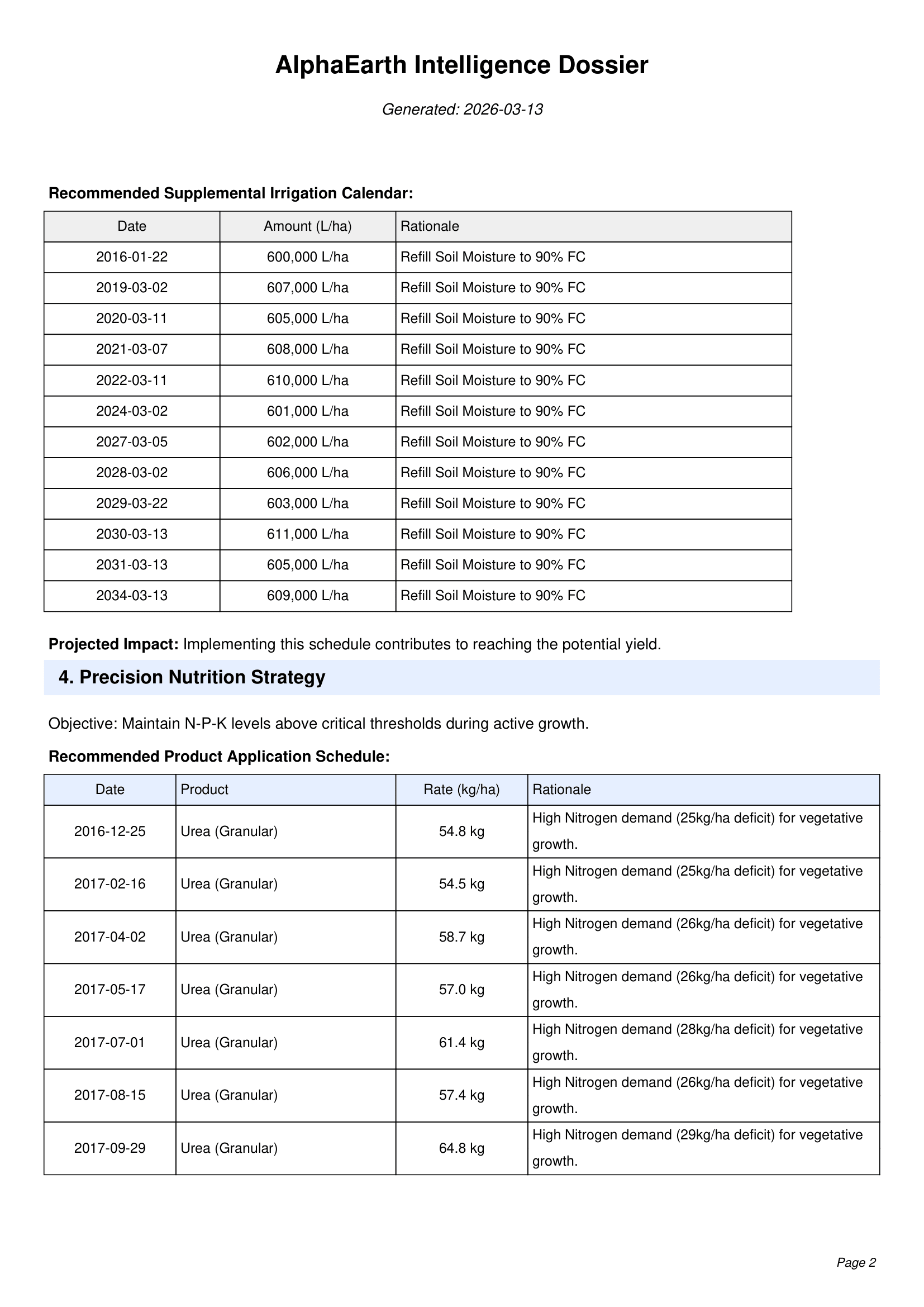
Custom irrigation and fertilization schedules based on the digital twin.
up to 40 % water savings
Evidence & traceability
Auto‑generated PDF reports: diagnostics, forecasts, action plans – ready to share.
yield gap reduced by 93 % on test case
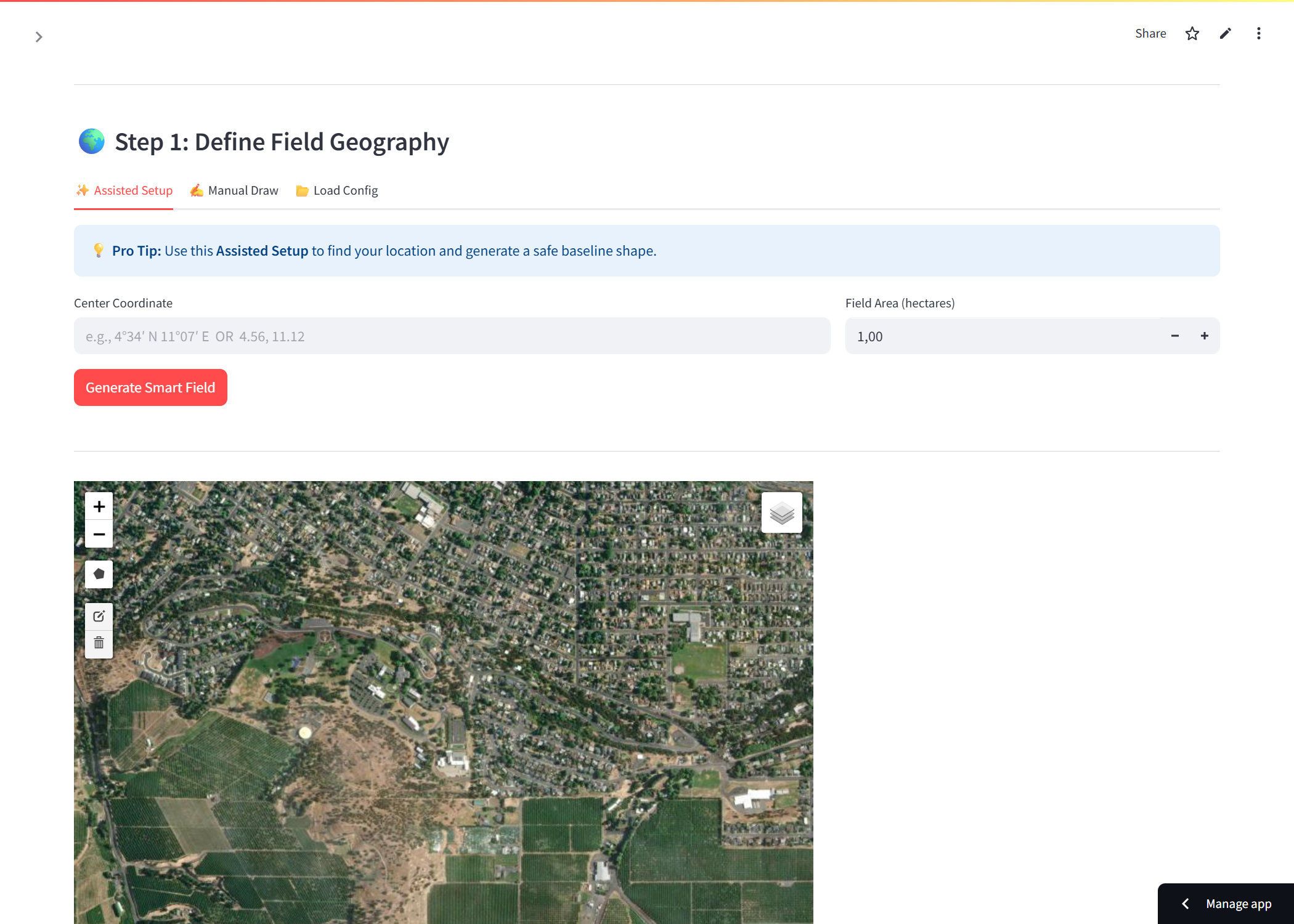
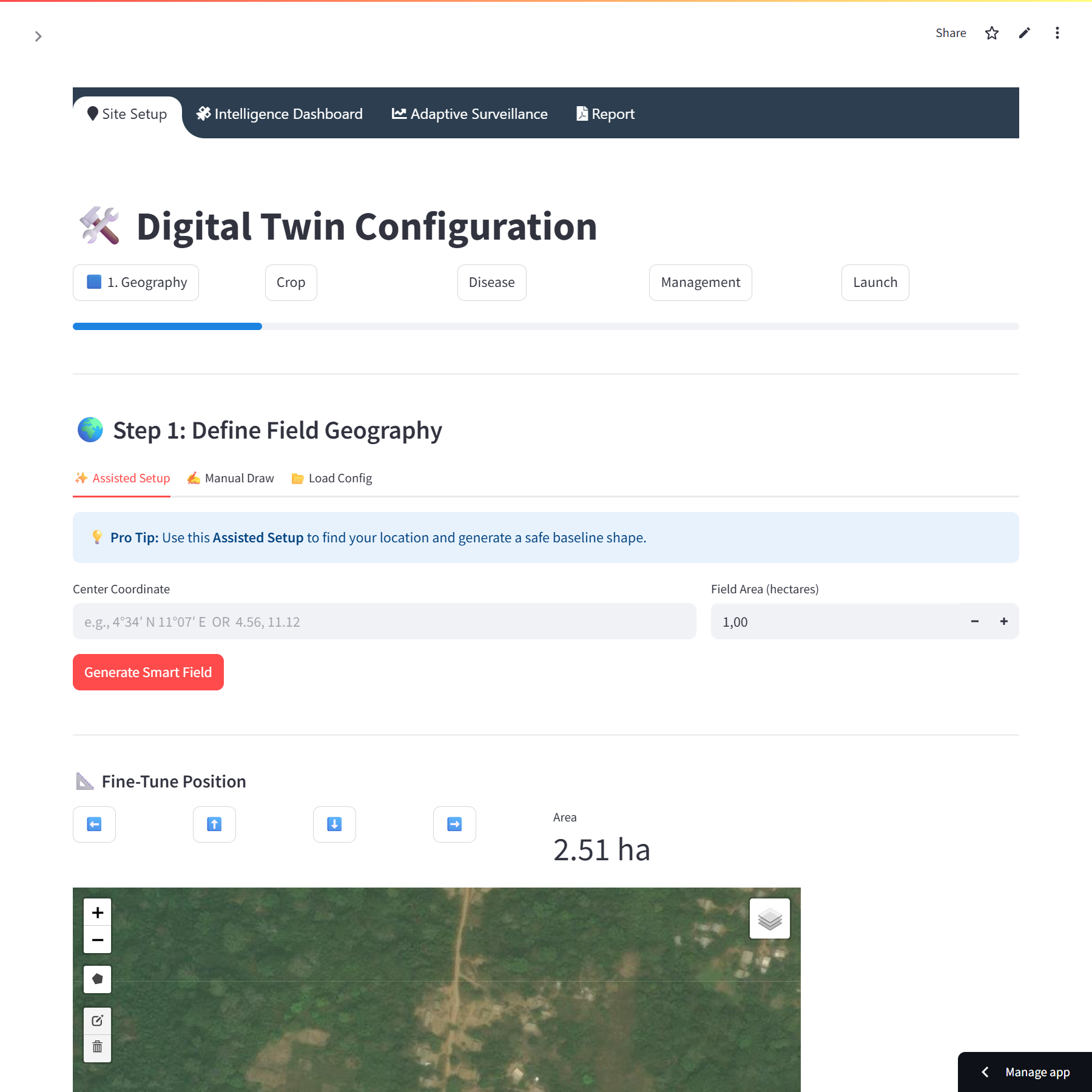
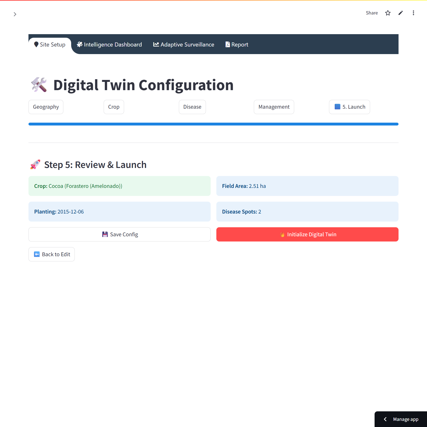
How it works – 9 key steps

Key features
🌱 Agronomic Digital Twin
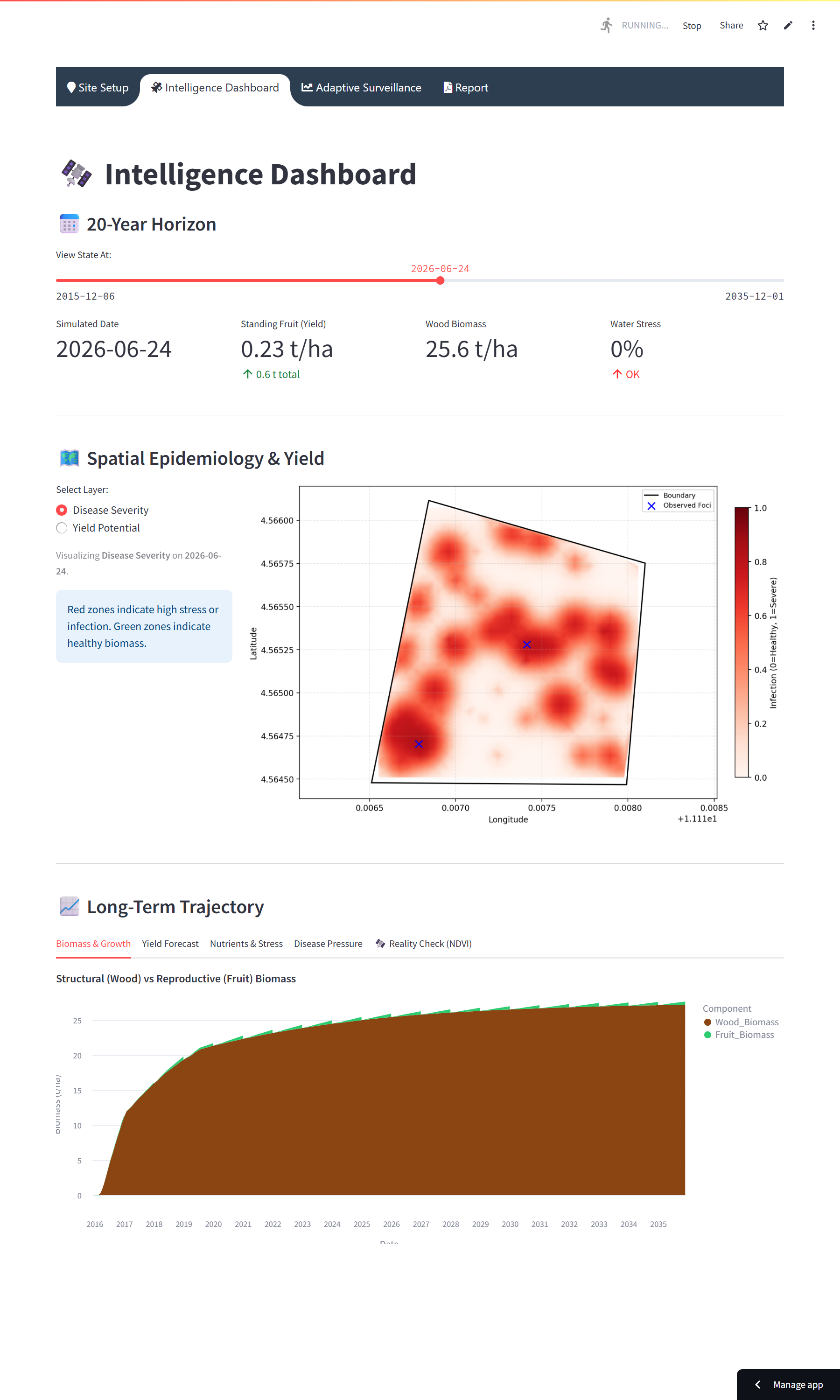
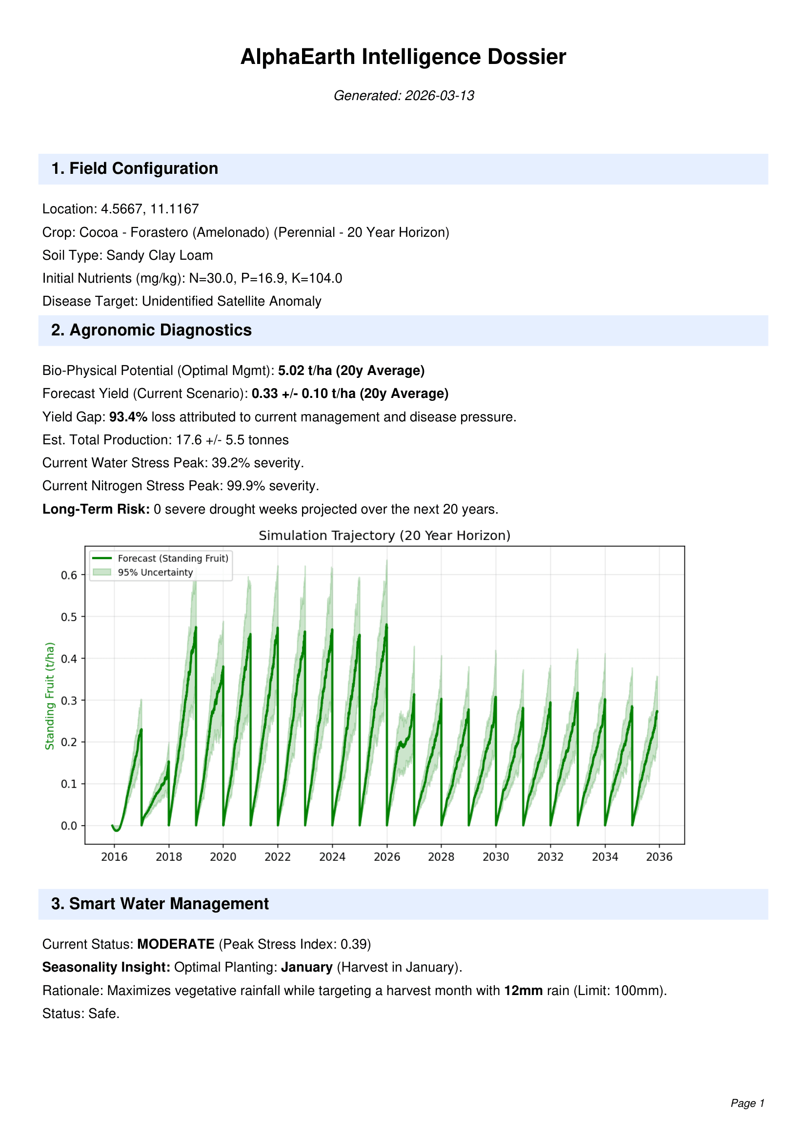
Biophysical model coupled with multi‑year simulator (perennial or seasonal). Why it matters: plan investments over 5‑20 years, anticipate yields.
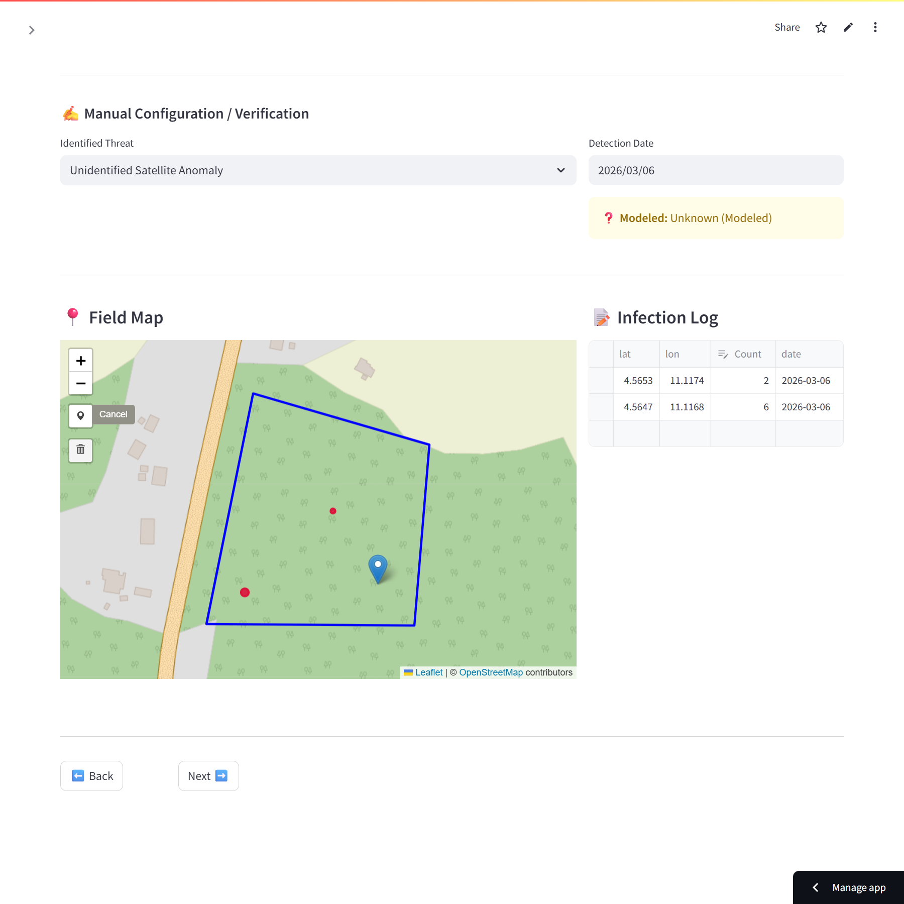
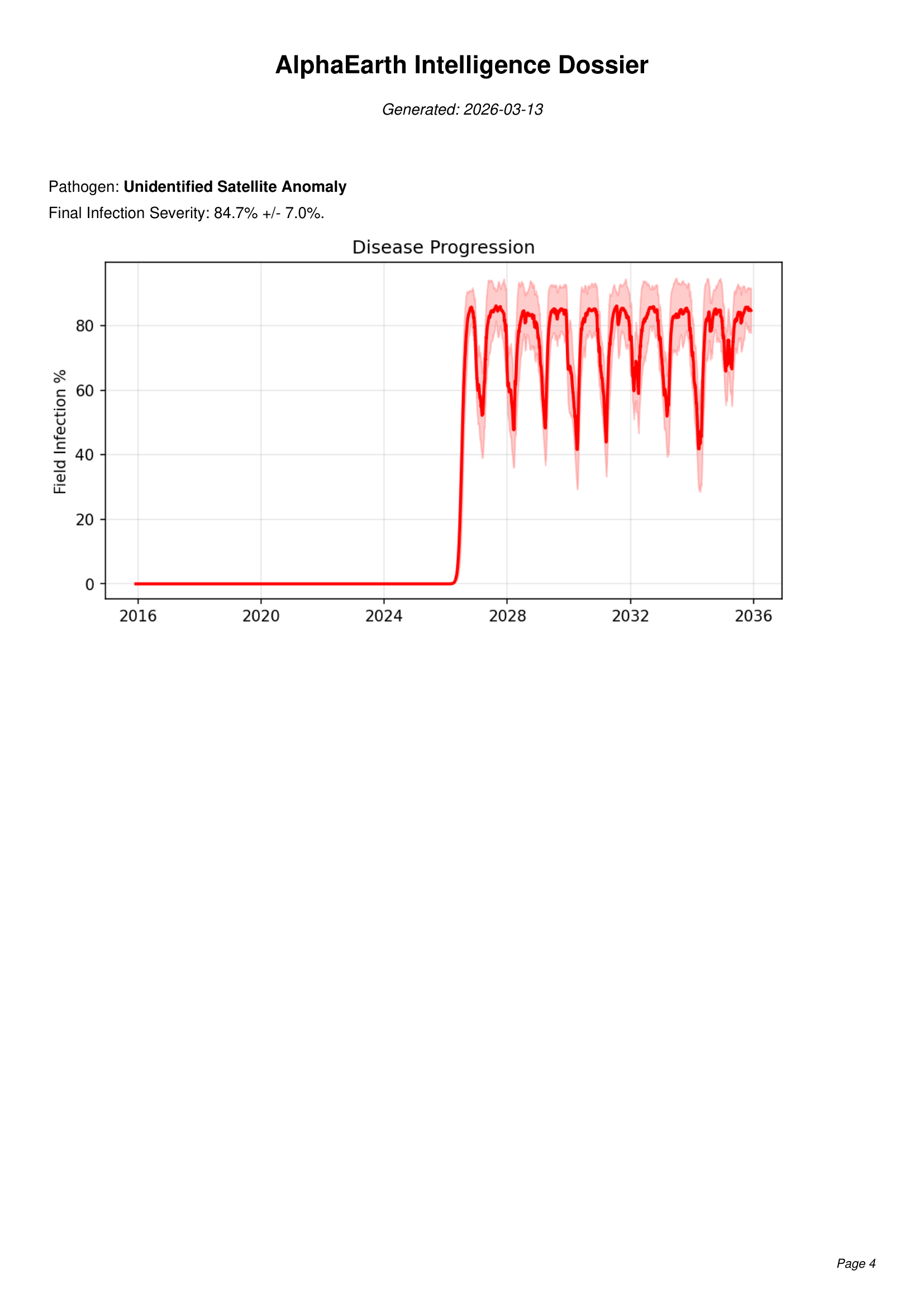
🦠 Disease Ensemble (epidemiology)
Multiple statistical simulations (configurable n_runs) → final severity map + confidence intervals. Use case: intervention thresholds, eradication decisions.
🛰️ Sentinel‑2 / Earth Engine
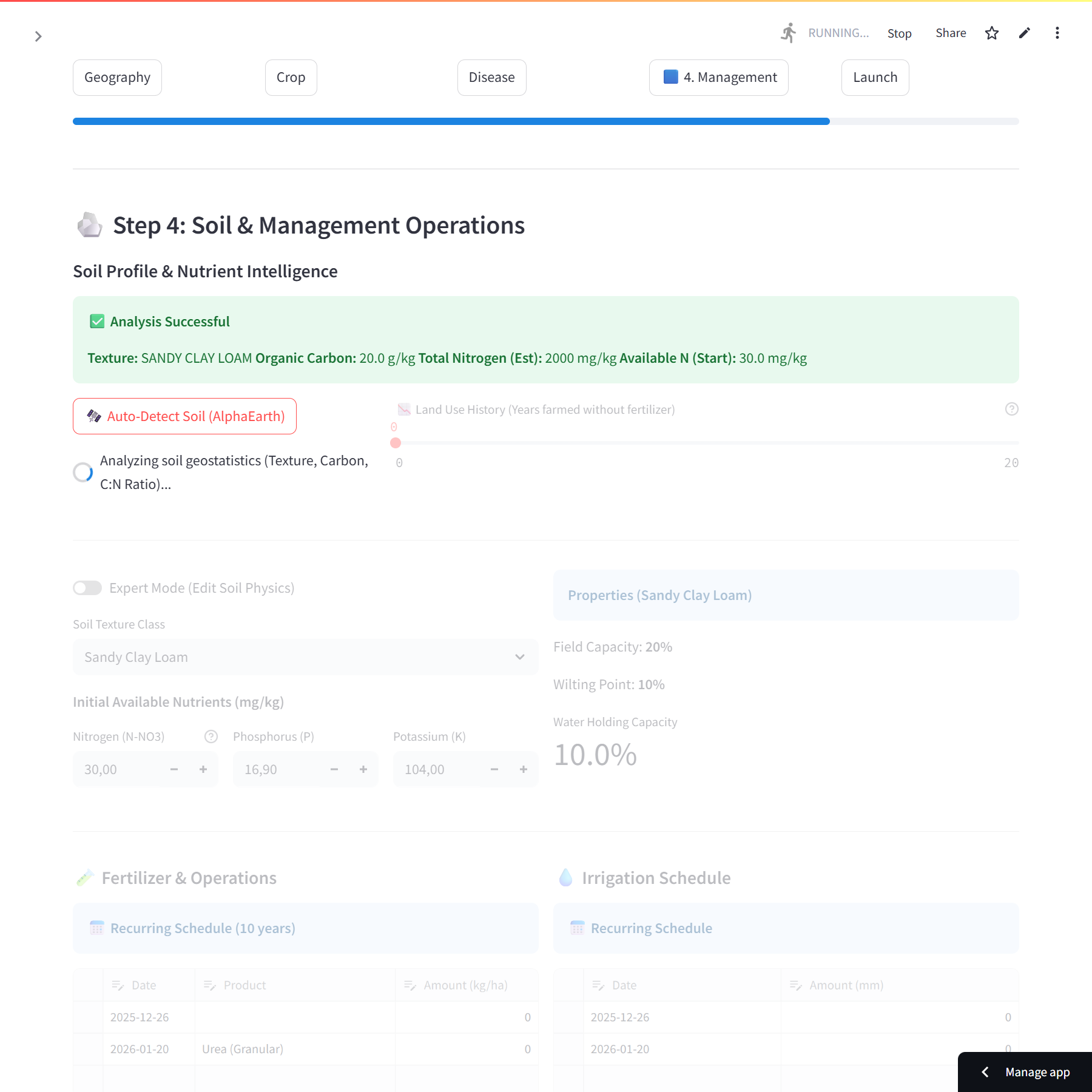
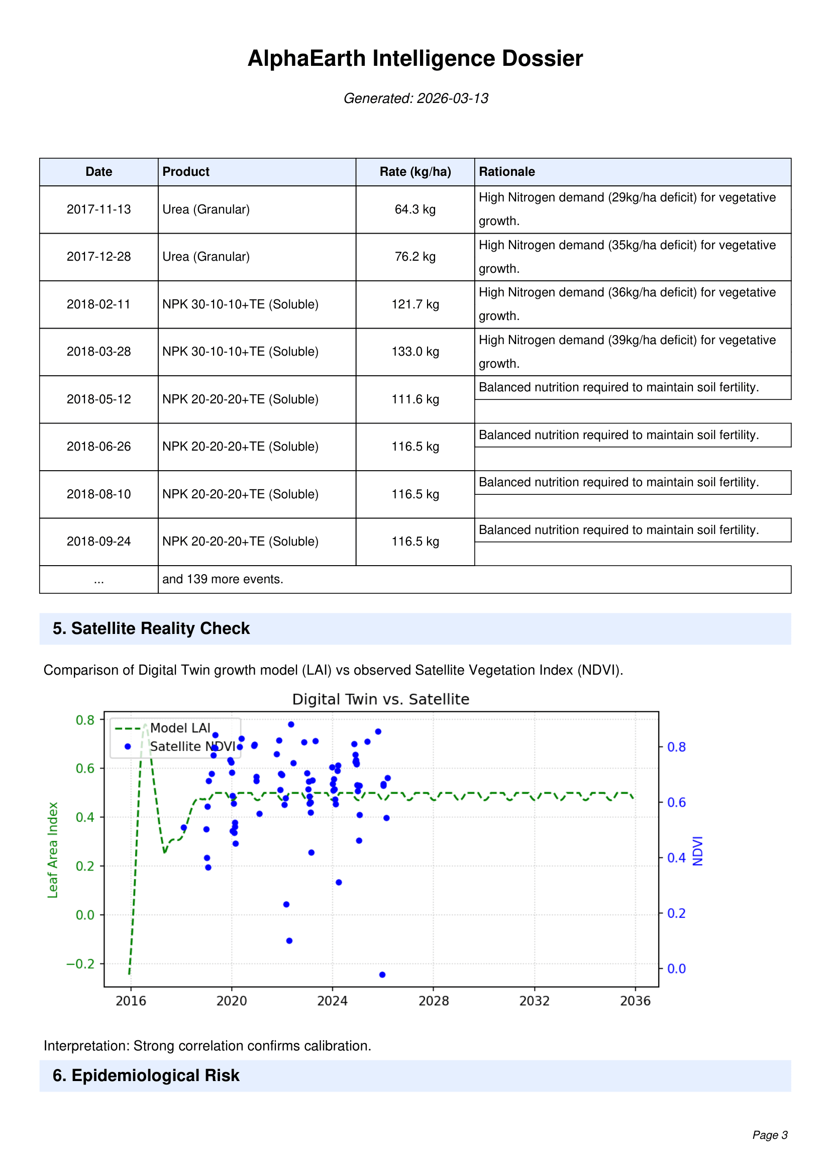
Automated ingestion of LAI/NDVI indices, textures, organic carbon (OpenLandMap). Why it matters: stress self‑detection and soil profile without costly sampling.
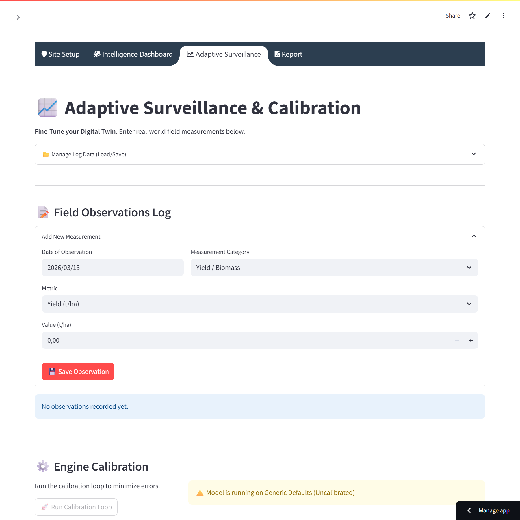
⚙️ Adaptive Surveillance & Calibration Engine
Field logs → differential evolution → model parameter update. Why it matters: from generic to site‑specific model, more accurate forecasts.
💧 Irrigation & Fertilization Optimizers
Custom schedule (L/ha, kg/ha) with yield impact. Why it matters: reduce water/fertilizer waste, close the yield gap.
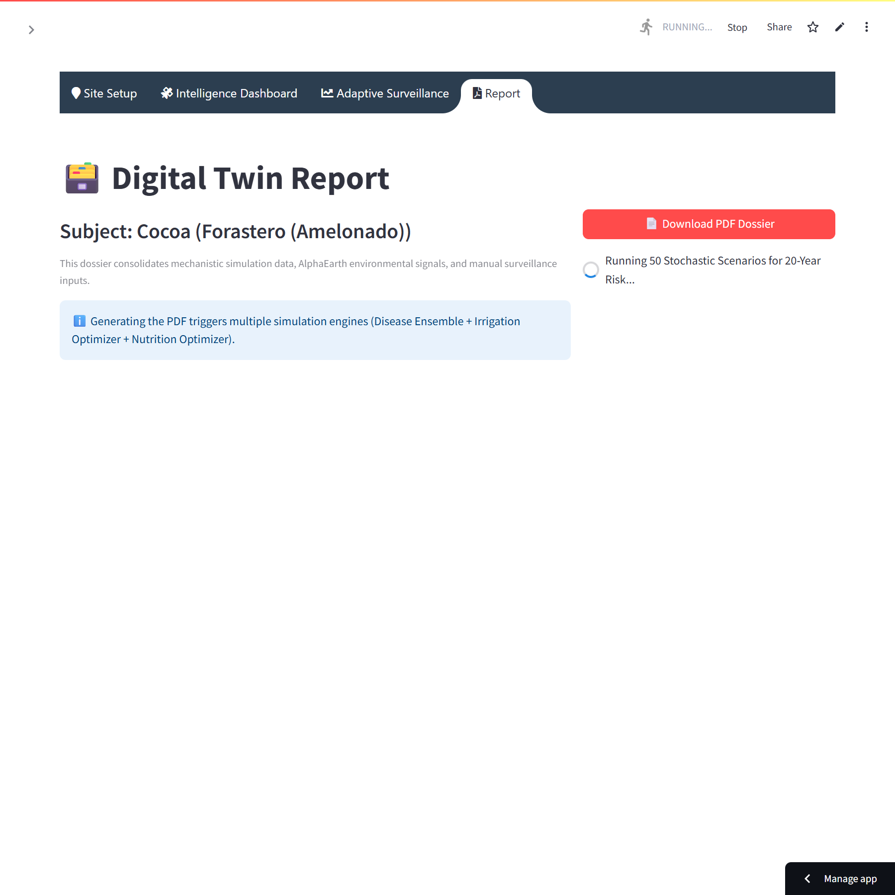
📄 PDF Report
Complete export: diagnosis, operational calendar, maps, graphs, recommendations. Why it matters: technical document for funding, audits, advisory.
Sample generated report
Real case: cocoa field in the Grand Mbam basin, Yorro, Bokito district, Cameroon (4°34’ N, 11°07’ E).
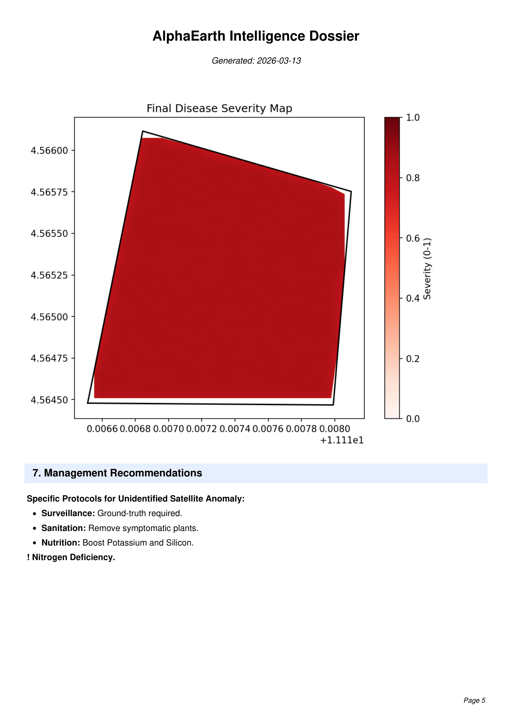
The report contains: field configuration, diagnostics (potential vs forecast), irrigation schedule, nutrition strategy, disease severity map, operational recommendations.
Technology stack & integrations
- ✅ Google Earth Engine (OpenLandMap, Sentinel‑2)
- ✅ Proprietary simulation engine (SimulationEngine)
- ✅ CalibrationEngine (differential evolution)
- ✅ Frontend: Streamlit + folium (interactive maps)
- ✅ PDF export via FPDF, JSON import/export
- ✅ Code‑protected access (XOR + base64)
- ✅ Private hosting available (on‑prem / VPC)
Security, governance and privacy
Satellite data is consumed through dedicated service accounts – no exposed keys. The application allows full JSON export for auditing or integration into your own systems. Fields and results remain under your control (local storage). For strategic clients, deployment on your infrastructure (VPC/on‑prem) is possible.
See our privacy policy for details.
Use cases & ROI
🌍 Cocoa cooperative
- Yield‑gap reduction of 93 %
- +400 % production in 2 seasons (real case)
- Traceability for certification
💧 Irrigation operator
- Optimized irrigation schedule
- Up to 40 % water savings
- Better drought resilience
📊 Advisory service
- Standardized technical report generation
- Argument for funding and audits
- Competitive differentiation
Technical specifications
| Inputs | GeoJSON polygon, planting date, soil overrides, disease spots, surveillance logs (JSON) |
|---|---|
| Outputs | Simulation ensemble (JSON), irrigation/fertilization schedules (CSV/JSON), PDF report (FPDF) |
| Core modules | SimulationEngine, DiseaseService, FertilizerService, CalibrationEngine |
| Dependencies | Google Earth Engine, Sentinel‑2, OpenLandMap |
| Security | Token‑based access, private hosting available |
| Export | JSON / PDF / images / shapefiles (optional) |